|
streets and
houses
street
index
Bancroft Road
Berryfield Road
Blind
Lane
Church
Street
Corby
Road
High
Street
Mill
Road
Rockingham
Road
School
Lane/Dag Lane
Water
Lane
Bury
House/
Hunting
Lodge
The
Rectory
forest
lodges
|
Streets and
houses
|
|
17th
Century map Reproduced
by kind permission of the Record Society |
roads and street names
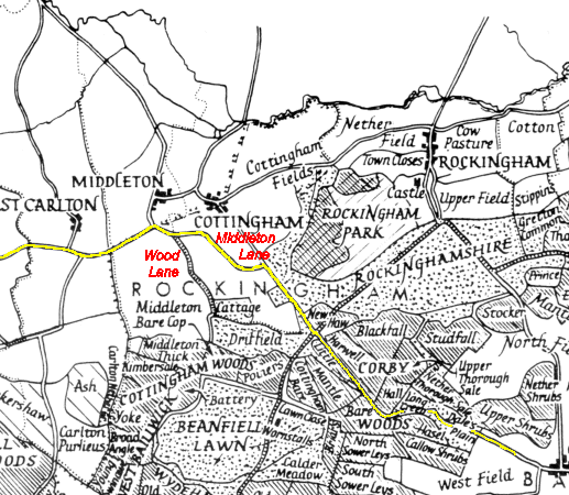
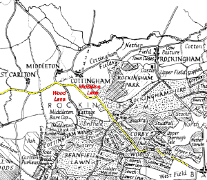
Before
the new A427 was built, it used to meander through Cottingham, Middleton, Stoke
Albany and Wilbarston following the route of an old 'turnpike' road (route marked in yellow on the map
opposite).
Turnpike Roads
(named after a toll bar placed across the road) were created from around 1750 on
major routes. Upkeep and repair were paid for from tolls, collected from traffic
using the road from specially-built toll houses. The 1841 Census records a
dwelling called 'toll gate' in Cottingham. In
1840, turnpike road repair costs for Cottingham were recorded at £14/2/-.
Middleton
Lane, the
road running across the top of the Dale, lies along the route of a medieval
track, and Corby Road follows the route of a
Roman Road running from Huntingdon
to Leicester.
|
|
Running south off Middleton Lane
(towards Cattage field) was a track called
Wood Lane, which is recorded in the
1841 Census. This still remains as a bridleway, joining Middleton Lane and the
A427. Both Middleton Lane and Wood Lane are shown on the 17th Century map
above.
In 1841, the street names in
Cottingham were very different to the ones we see today, with only Blind
Lane and High Street remaining (see Street index). I have taken a stab at
which old street names correspond to the modern ones, but would appreciate any
help you can give me on this one!
It may seem logical that the 1841 Church Lane became today's Church
Street, but I'm not convinced. The 1841 Census shows
John
Chamberlain (Grocer) living on King Street, and we know that he had a
shop in Church Street in 1861, so it would seem more likely that King Street
became Church Street - and maybe Church Lane became Water Lane? Again, if anyone can confirm this one way or the other,
I'd love to hear from you.
The road names in
1881 and 1901 were pretty much the same as today, except
that Dag Lane and Pinfold Bank no
longer exist in the village. The
crossroads at the centre of the village is still referred to locally as The Cross. Dag
Lane took it's name from the droppings that hang from a sheep's underside (yeuch!!).
This road has since been renamed School Lane - little wonder really!
Pinfold
Bank was on the right hand side at the bottom of Blind Lane.
|
|
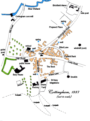
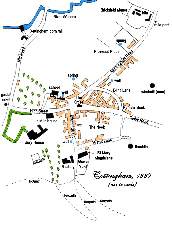
Street
map, 1887
|
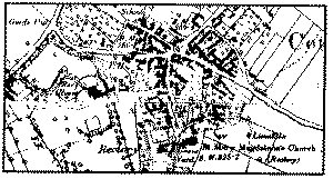
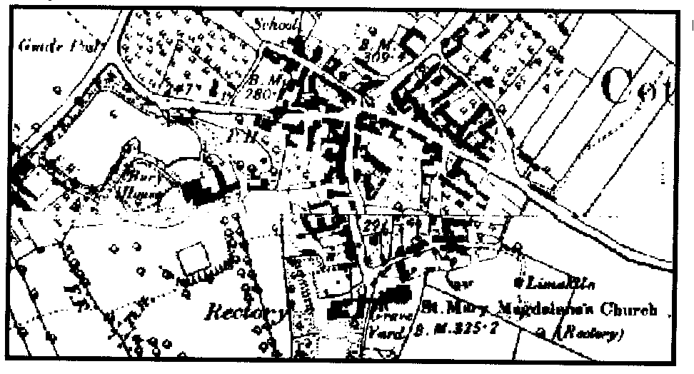
OS
map, 1887
Image produced from the www.old-maps.co.uk
service with permission of Landmark Information Group Ltd
and Ordnance Survey
A modern OS map of
Cottingham is available at www.multimap.com
|
|
|

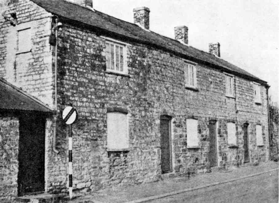
Row
of one up, one down 19th Century Cottages, Corby Road
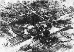
Rockingham Road and Blind Lane, c 1930
|
houses
In early medieval times, most dwellings in
Cottingham would have been fairly temporary wattle and daub structures, needing
rebuilding every generation. Most were single-storey, consisting of one or two
rooms, with floors of beaten earth, covered with straw. Peasants often shared
their homes with their animals, and life expectancy was 40 to 45 years.
Some of the ironstone cottages in the village
date back as far as the 14th Century.
In the
19th Century, many 'one up, one down' cottages were built in Cottingham and the
surrounding area for labourers and their families. As the name suggests, these
houses had just one downstairs room, and one upstairs room. The picture opposite
shows a row of one up, one down cottages that used to stand on Corby Road, next
to the entrance to Blind Lane.
The
cottage on the left is actually two up, two down.
Mike Williams tells us: "My
grandmother Mary Monk kept house for the occupant who was Harry Goode. She
stayed with Harry from 1939 to 1962 although they did move to the new Council
House development in Middleton in 1950s. The
blocked off door by the cottages (behind the traffic sign) was where the bucket
toilet was sited along with all of Harry’s gardening tools. There wasn’t a lock
on the door so every one sang very loudly."
In 1901, more than half of the families in the village were living in four rooms
or less, with two couples' accommodation consisting of just two rooms. And spare
a thought for 44 year-old widow Sarah West bringing up eight children in just three rooms!
|
|
At that time there was no mains water, and water for washing, cooking and
toilets was collected from the
pumps and wells around the village. Few (if any) cottages had inside toilets. Some loos were much as
we know them today, except that you had to tip a bucket of water down to flush
them. However, some people just used a wooden plank with a hole over a cesspit.
Worse still, some used buckets, and the waste was collected by a lorry that went
around the village. Mmmm - nice job!
David Dodd, who lived on
Frog Island, Rockingham Road in the 1930s
and 40s recalls: "A brick built 'privy' was located also about 20 yards down
the garden, right next to the pump for the drinking water! The construction was
no more than a deep pit in the ground with a wooden box over having two circular
holes in it, one large and one small. Each privy was shared by two families.
When the time came to empty the pit the men of several families would join
forces to ladle the 'sludge' into wheelbarrows and deliver it to a pre-dug
trench in someone's garden. Turns were taken to receive the 'sludge' as it made
good manure. I can still remember trotting down the garden path at night,
matches and candle-stick in hand, with advice to 'be sure to use the small
hole'."
|
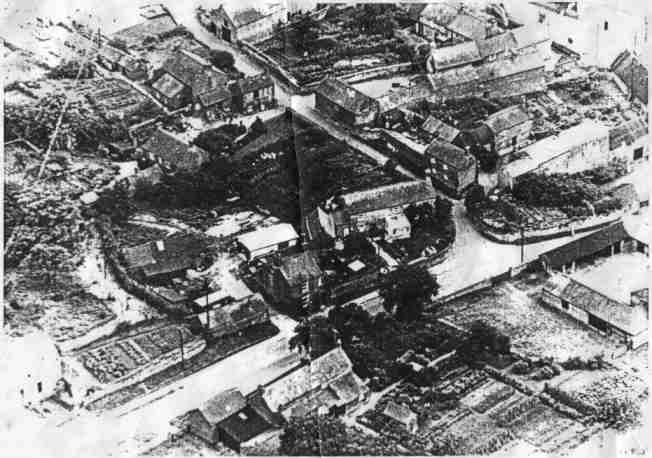
|

1996
|
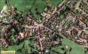
c2001
Photograph derived from 2m
resolution aerial photography supplied by Getmapping
plc.
|
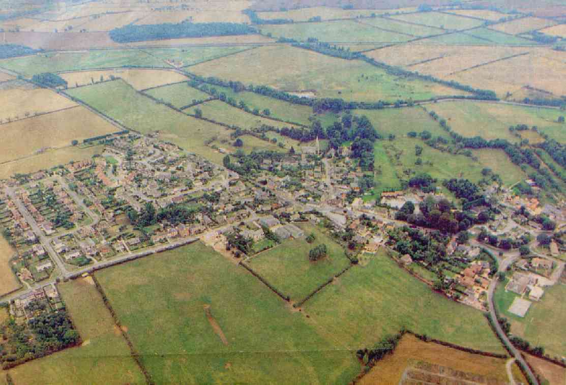
|
2001
In
2001, there were
372 homes across
17 streets. The 2001 Census for Corby's rural west ward (Cottingham,
Middleton and East Carlton) reveals the following about the households in the
area:
-
84% of houses were owner
occupied, with the remainder being rented
-
the average number of rooms in
each house was 6.3
-
Only 2% didn't have central
heating
-
All had sole use of a bath,
shower or toilet
back to top of
page |
|
|
|