|
The
boundary stone from
the
village boundary with Corby
|
In the Middle Ages, every year, on rogation
day, the villagers walked around the boundaries of the village to 'mark' the
traditional boundaries that separated Cottingham from neighbouring villages. The
ceremony, which involved the use of sticks and lots of noise to scare off
malicious spirits that lingered in the crops, became known as 'beating the
bounds'.
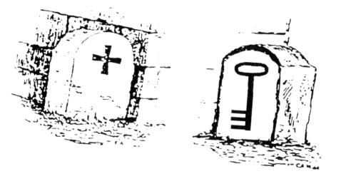
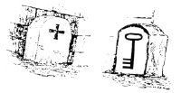
The boundary between Cottingham and Corby was marked by a boundary
stone, with a key symbol on the Cottingham side and a Greek
cross on the Corby side.
This was located on the medieval track of Middleton
Lane. Running into Corby, this is now Cottingham Road, and there is a petrol station on
the site where the boundary stone stood. Unfortunately, this stone
was removed in the 1970s.
The same symbols were
used to identify animals from
Cottingham and the surrounding villages grazing on Rockingham Forest
common land. |