|
The
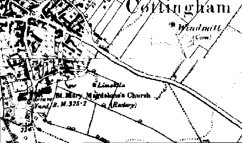
1887 OS
map (opposite) shows
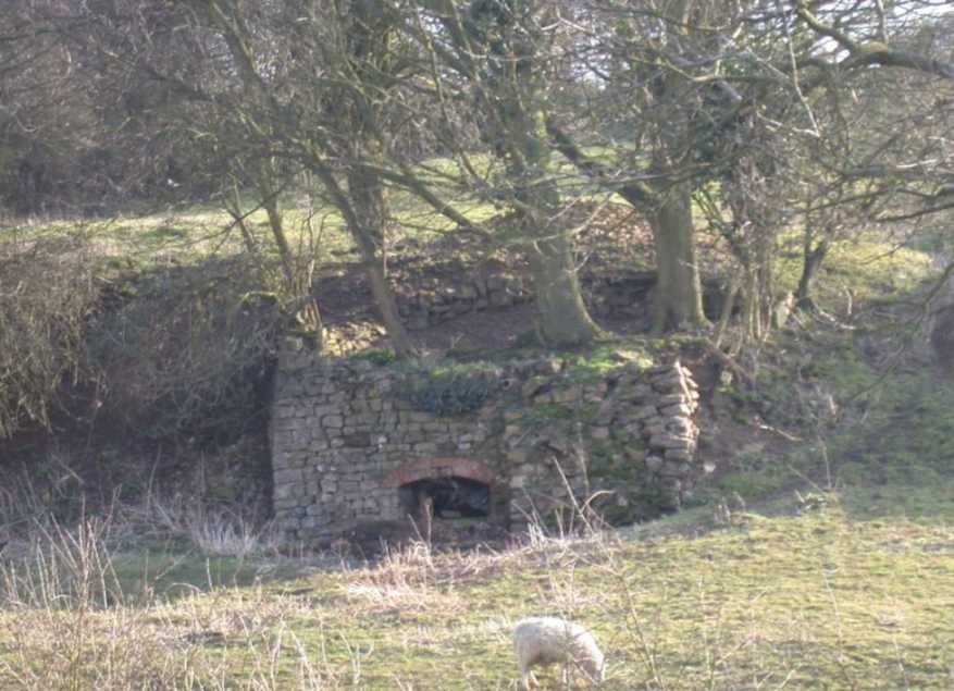
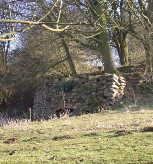
a limekiln on land leading off Water Lane. The remains of the limekiln can
still be seen on this land.
In
the 18th and 19th centuries, limekilns were built across the UK to
produce lime - a white powdery substance used for building (mortar and
plaster) and also farming - as a fertiliser.
Lime
was produced by burning limestone, which was tipped in from the top of the
kiln on to a coal fire. Then a layer of coal was laid over the top
followed by more limestone, more coal and so on.
The furnace had a wide
arch at the front, to allow in a supply of air at the base to keep the
fire going and provide oxygen for the conversion process. As the fire
burned, the lime was raked out of the furnace and taken away.
The
picture below is of a surviving limekiln in Dunbar, Scotland. From this,
you can get an idea of what the Cottingham limekiln looked like before it
fell into disrepair.
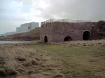
Limekiln,
Dunbar
With
thanks to www.dunbar.org.uk
|